Most don’t make it to Fiordland and Stewart Island. It is a long way from the cruiser centers on the northeast coast of the North Island. For those considering this amazing trip, I’ve summarized the nitty-gritty details and compiled up-to-date information from our time there during the summer of 2021. We did this trip in a counter-clockwise direction from Cape Reinga (the north cape of the North Island) to Stewart Island. Our plan is to return to Whangarei via the east coast.
It was not easy to find recent cruising guides covering these areas. We relied on A Boaties Guide to Fiordland and the Stewart Island Cruising Guide, both from the Mana Cruising Club. We also used Beneath the Reflections from the New Zealand Department of Conservation (DOC). The Mana Cruising guides are from 1994 and 1996 respectively and while the DOC guide was from October 2020, there was a lot of out-of-date information. Our best local information came from sitting down with people who had been there and then picking their brains.
Download a printable versions of this post here:
Anchoring
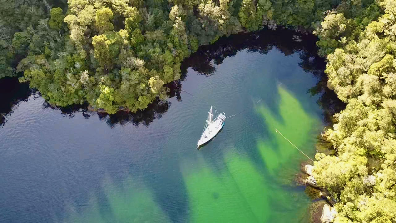
Fiordland is known for deep anchorages. It is also known for extreme weather. Getting tucked up to shore as closely as possible is the best way to stay out of the strongest winds. Due to the steep and deep bottom contours, there is usually not enough of a shelf to free swing in the most protected anchorages. We were nervous about anchoring in Fiordland. Stern-tying to shore or to fixed lines or side-tying to a fixed line are all things most equatorial cruisers have never done. It really isn’t that scary once you get the hang of it.
Equipment: In general, we are very conservative. We spent most of our nights in “all-weather anchorages” and were amazed at the prevalence of stern lines and side tie lines. The condition of these is inconsistent and at times hard to assess due to the prevalence of marine growth. We use a Rocna and carry two 300’ slugs of chain but never needed more than 250’ and that was with my typical 7:1 scope. We have a large collection of long lines but when anchoring, we never needed more than two 200’ stern lines(one time). Our most line-intensive anchorage was preparing for a forecasted 50 knots when no more than 15 knots ever crossed our bow (this involved an additional bowline to shore). We did find it helpful to have a 100’ floating line when pulling longer lines from shore using the dinghy. There was no need for webbing on spools as is sometimes seen on expedition boats. Just pull in the line and flake it or stuff it into a bag or locker.
Infrastructure: Almost every anchorage has huge lines/hawsers available to stern or side-tie. These hawsers typically have short lines with eyes either tied or braided into them, handy for slipping onto a cleat or slipping a line through. It’s important to note that we shared very few anchorages with other vessels, part of this could have been 2021, but in general, you’re typically alone.
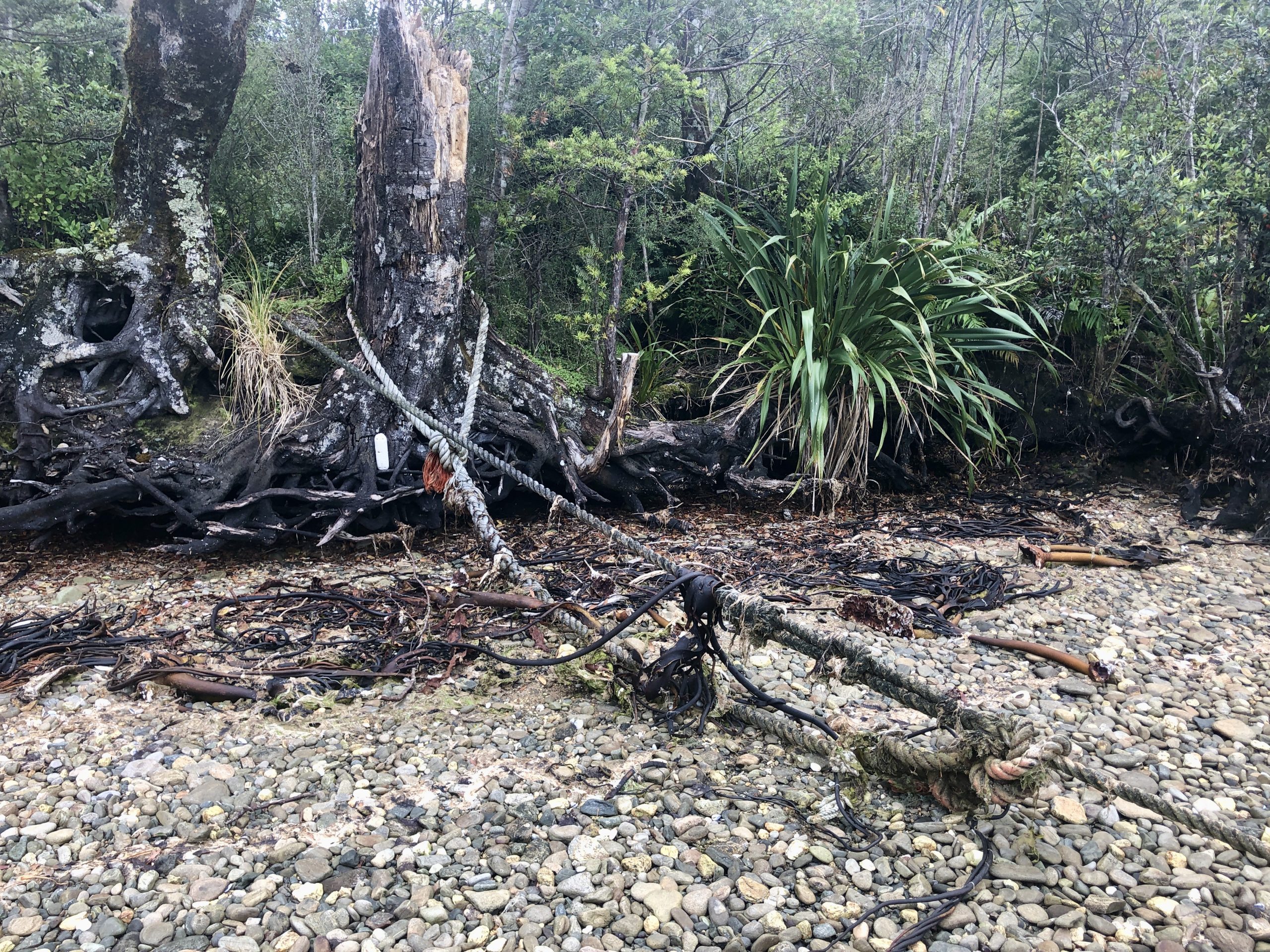
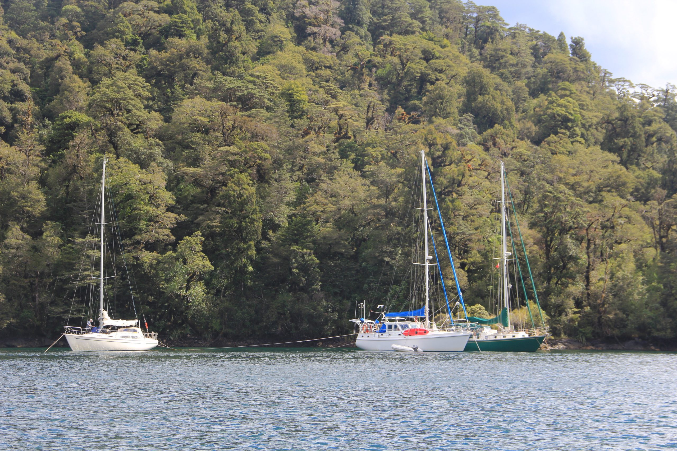
Technique: When side tying, the fisherman just pull up the eyes and slip them onto their bow and stern cleats, while using a line midships to keep the hawser from floating below the hull. It’s sometimes hard to tell whether you’re supposed to side-tie or stern tie but most of this depends on whether you expect more vessels and what the forecast is. It’s also hard to know on which side to tie. Plan to be blown away from, rather than toward the line. No matter how you side-tie to the line you will lose some bottom paint and might get the occasional mussel scratch. If eye loops are not available, you can either use a rolling hitch or many round-turns with both bitter ends led back to the vessel for an easy departure.
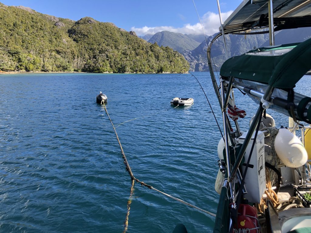
For stern tying, we would decide where we wanted to drop the anchor based on the amount of scope we wanted out, and drop a pin on Navionics (don’t forget that the stern line is going to pull toward you). If we had the dinghy down, we would drop the hook, then back up toward the stern line (plan to anchor before the wind picks up if reversing into the wind is a challenge for your boat). I would hop into the dingy, grab the bitter end of a line which Annie would feed out to me from the stern quarter as I went to the hawser. I would loop the line through the eye loop coming off the hawser and come back to the same stern quarter, passing the line to Annie. Same on the other stern quarter, then Annie would snug up the lines. Makes for an easy getaway.
If we didn’t have the dinghy down, then we would sneak up to the hawser with a boat hook, pull up an eye loop, connect our floating line through the eye then drive to our anchor spot while letting out the line as we went. After releasing the anchor, we reverse while taking up slack on our stern line. This is also a great way to minimize worry if your boat is uncooperative in reverse regarding directionality.
In conclusion, with 300’ of anchor rode and two 50’ stern lines you will be o.k. in 99% of the situations, with two 200’ stern lines for tying to shore, you will cover the other 1% of the time. It was not nearly as difficult as we expected it to be. The all-weather anchorage are so well protected that it was usually glassy when we were anchoring.
Fuel
Diesel is available in Milford, Doubtful, and Oban (Stewart Island). Petrol can be found in Milford although it’s hard to access without a car. It’s easy to access Petrol in Doubtful and Oban. Diesel in Milford requires cash or a bank transfer, you can use a credit card in all other locations. We found that carrying two 5 gallon petrol cans plus our 3-gallon tank for our 15hp motor was plenty for all the exploring that we did. That was with a good bit of dinghy fishing in Stewart Island. We only purchased Petrol in Doubtful and still had 5 gallons remaining. There are no supplies in Preservation even though the guidebooks say otherwise. LPG is available in Oban and this was our most limiting resource as we typically only carry a 60 day supply. One tip here is to carry a small AC electric kettle for boiling water if you find you have excess battery power.
We put 153 hours on our engine (Nelson to Dunedin) and 3% of that would have been charging at anchor. Prepare to motor quite a bit. The advice is to travel whenever the weather is good as you may be hunkered down for a week or more waiting for a window multiple times. We found there to be a wind shadow (or void) close to shore on the outside when traveling from sound to sound. The wind generally funnels into the sound starting late morning, so plan to leave early so you can motor out in light/no wind and hopefully sail in. We had some great downwind sailing in the fiords, at times making 90 degree turns following the fiords, always with the wind at our back and rarely gybing. This was mostly under genoa alone to allow us to quickly furl up if the wind built, which it can quickly.
Our boat, ‘Banyan’ is a 1979 Mason 43 with a 54hp Yanmar, we consume approximately 0.8 gallons per hour when being conservative. Regardless, we chose to fill up with diesel whenever possible. We do not have a generator.
Water
Each sound has at least one water hose. Most of these (other than Milford) are simply fisherman-built stream catchment systems with a long black hose that will reach a boat. These are typically near side tie lines or moorings. The water was the best tasting water in the world (easily 110 points on the 100 point Water Scale). It can have a little tannin in it which gives it a slight color (more visible in Pegasus on Stewart Island). The hose will be flowing and floating, if it’s not, it might take a quick hike to find the catchment and maybe a quick repair or unclogging but it’s typically pretty easy. We didn’t sterile filter or chlorinate this water, and we never had any issues… but we are not recommending that you don’t.
Heat
We do have a small diesel forced air heater and found we used it as we got further south and the season got later. It was nice in Fiordland as it helped to dry out the boat. In Stewart Island we found it to be a little cooler yet drier. A heater is not required but even the Kiwis were using theirs.
Hiking
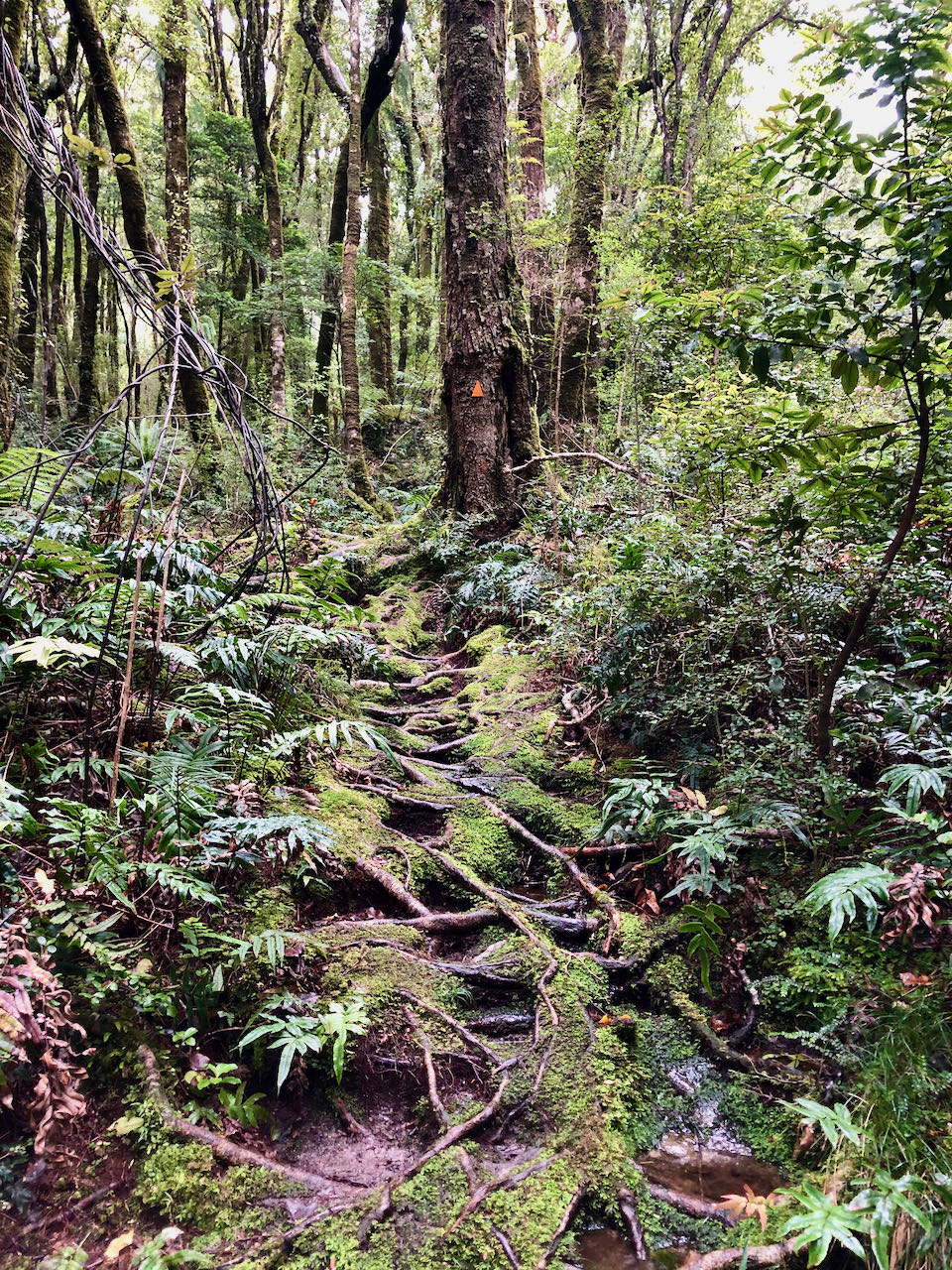
If you’re really into hiking and getting off the boat then I would devote research time to this before departure. There are devoted hiking books and maps for this area. We found the cruising guides to be particularly out of date in this area. One of the many offline topo apps such as NZTopo50S or Maptoaster might also be helpful. We struggled to find many trails listed in the cruising guides both in Fiordland and Stewart Island. We met hikers and pack rafters that were hiking extensively in Fiordland and finding the trails, they were more prepared than we were in this department. If you like hiking, focus on Doubtful (Deep Cove), Dusky, Preservation, Patterson, and Pegasus (the latter two on Stewart Is.). The DOC office in Oban has nice maps of Stewart Island but if you follow our route, it’s the last stop. Due to the mud, we hiked primarily in mid-height rubber boots, aftermarket innersoles are recommended. This is just easier than fancy hikers that might not dry out each day. We did a longer 10-mile hike on Stewart Island and it was dry enough (at times) for cross-trainers.
Sand Flies
They were not as bad as we had expected. But, we were prepared… We found some anchorages were worse than others. Sandflies are prevalent close to shore. If the weather and depth allowed you to anchor out, there were very few sand flies. Once you were onshore in the bush, moving at a walking pace or a breeze kicked up, they disappeared.
Head Nets: This is essential, even the crusty guys had them. Lightweight black nets from the tramping stores were easier to see through and more comfortable than the heavier light green ones we found at the army surplus store.
Screens: Annie had purchased a cheap gauze curtain (mosquito netting is not tight enough) and cut it to fit a few portholes and covered all the inner tubes of our dorade vents as well as the vented companion-way door. We already had really tight mosquito nets for our hatches and the companionway which worked well.
DEET: Annie makes a pretty gnarly bug spray that contains 15-20% deet, but is suspended in coconut oil with a cocktail of essential oils which bugs evidently don’t like. We would put this on our wrists and hands to good effect.
Other Stuff: We had mosquito coils which we burned inside an old cookie tin and set in the companionway (under our dodger and within the cockpit enclosure) which seemed to keep them from collecting in a huge mass right at the companion-way door. We also had citronella candles but those didn’t seem as effective.
Weather and Sat/SSB Communications
We’re still a little old school and rely on SSB/grib files for most of our weather. I’m also a minimalist/lazy when installing things I don’t necessarily need. We had never installed the optional GPS antennas for our Standard Horizon Explorer VHF (purchased in 2015) nor our VESPER AIS (more recently added). Upon arriving in Milford both had a hard time finding a GPS signal. We had also rarely used our optional Sat phone antenna. Within a couple of days, the two GPS antennas were permanently installed on the solar arch and the sat phone was useless without the extra hockey puck antenna placed on a metal pie sheet and set above decks. Even the SSB was struggling a little in Milford. As we got further south and the fiords opened a little I was getting the fastest SSB connections I’ve ever recorded (we were almost at dialup speeds!). The Sat phone still struggled but with super-fast SSB connections, we were fine.
The good news is that due to the safety-conscious mariners in NZ, the VHF repeater network in this area is first class and is always being updated. It took us a little while to figure out the schedules but once we did we had no problems getting VHF weather in most sounds. We found the easiest thing to do was to put all the VHF channels listed below on scan and then we were sure to know what was going on. We also added channels 8 and 10 as those are the channels the fishermen use for communicating locally. We chose to check in nightly with Meri “good as gold” Leask at Bluff Fisherman’s Radio. We did find wifi at the Milford Sound Lodge, it was not expensive and they have a nice little cafe. That was our only internet until we reached Oban where the library has free internet and it’s on all night long.
Radio Weather Details
Met Service Weather: Daily 0133, 0533, 0733, 1333, 1733, and 2133. Channels 68, 69, 71. We could always get this on the outside and occasionally inside as we worked our way further south. It was always available on Stewart Island. The Maritime NZ Radio Handbook is worth having if you can find one, you can also download them here. This book references all the coastal weather forecast areas in the back and is a great resource.
Meri Leask, Bluff Fishermans Radio: We first caught up with Meri in Doubtful Sound but you can occasionally get her as far north as Milford on the West coast and will catch her south of Dunedin on the East coast. Depending on where you are you will catch her on VHF 66 (Milford, faint), 61 (George to Doubtful), 18 (Breaksea/Dusky), 01(Inside Dusky to Stewart Island), and on 64 between Nugget point and Dunedin. You can also get her via SSB on 4147 Mhz but we struggled with this as we had a lot of noise on this channel. Coming up the East coast we were in contact with Meri on channel 64 as far as Dunedin. We still do check in’s with her by text.
Meri broadcasts weather every morning at 0710 (Ch61), 0715 (Ch65), and 0720 (4147Mhz). She runs a VHF sked every evening at 2010 (Ch65), 2015 (Ch01), and 2030 (4147Mhz). These times are approximate as it depends on how many folks are checking in. She will rebroadcast weather upon request at any time. We found checking in with Meri added to our otherwise lacking social life, we also gave our family members her contact information in case they ever needed to get in touch with us. She is a legend down south. She has a really cool story and works hard to provide a safety net for fishermen and boaties. If you feel generous you can also send her some beer money when you’re done. We appreciated her services.
Stewart Island Marine Radio: Maureen does weather at 0800 and 1700 on ch. 64. And then also on 4147 just after the VHF broadcasts.
Groceries
We provisioned for a solid three months before leaving Nelson. To our surprise, we found we could order in groceries to Deep Cove, Doubtful Sound. Billy at the Deep Cove Hostel placed our order via email with the grocery store in Ta Anau and it arrived the next day on the bus and replenished our fruit and veg. We paid Billy with a credit card. The only other place will be Oban, which has a fantastic little 4 Square.
Fishing
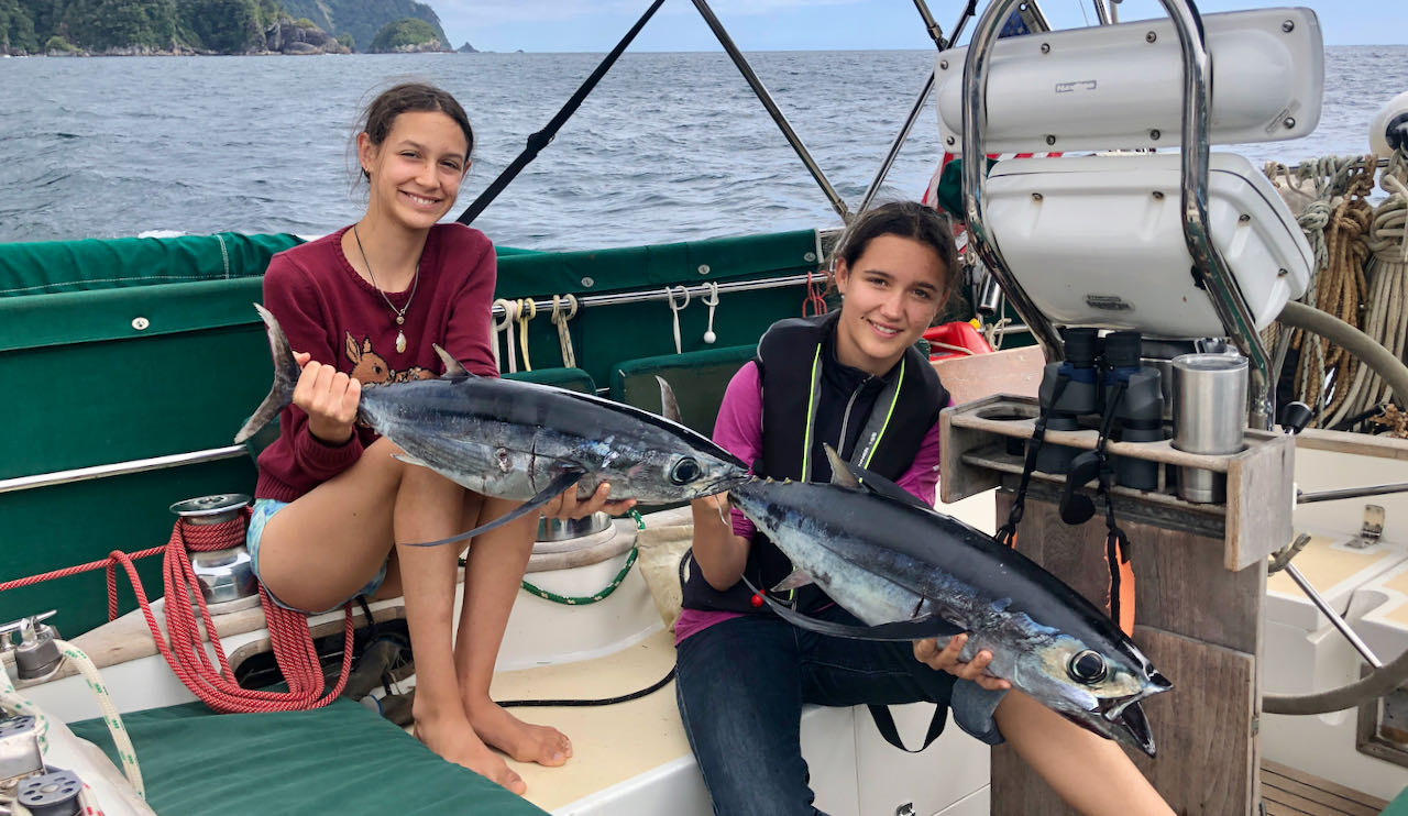
We have two dinghy fishing rods, a handline that has a siduki rig on it (for bait fishing), and two reels on the stern for trolling. We were catching cod in many locations along the rocks, on the bottom from in 10 – 50ft. The heads of the sounds are the best but we found them difficult to fish from Banyan. Typically when entering or leaving we rarely had our dinghy down. We found an abundance of cod in rocky locations and occasionally caught large cod while bait fishing in shallow water. There is an abundance of crayfish and paua if you dive.
Trash & Recycling
We’ve always struggled to figure out trash in NZ. It’s not like other countries where there are prevalent public trash and recycling bins. Each locality has its own rules, schedule, and unique bags. We were able to dispose of trash in Milford but no recycling. Oban has full trash and recycling available next to the library. There were no provisions for trash during the six weeks between those two locations so plan well. Cardboard and paper can be burned at the DOC huts along the way. We keep our trash dry and wash all glass. For cans, we remove both ends and flatten them.
Itinerary
The Pre-Fiordland Itinerary: We departed the North Island from Cape Reinga in mid-December, heading down the West coast. We dropped into Able Tasman (loved it), headed to D’Urville Island (blue cod!), then settled into Nelson for services and provisioning before departing for Fiordland.
We chose to go in a counter-clockwise direction. We departed for Fiordland from Nelson on the morning of February 4th and arrived in Milford the morning of the 8th. While in Fiordland we felt most people were going clockwise (Stewart Island, then north through Fiordland). The challenge with this direction is the passage from Stewart Island to Fiordland. It can take weeks to get a weather window and historically there have been boats that never found a window. That was not the case this year.
Most cruisers sail this area in the summer, and we’ve heard that February is usually the most settled, but Fisherman and charter vessels frequent these areas all through the year, including winter which has some advantages. Again, find people who have been down in these areas and get their thoughts and advice.
When going from Fiordland to Stewart Island, if possible, try to round the southern end of Stewart Island first and work your way up the East coast of Stewart Island. This is because it is tough to get a window to sail south, down the East coast of Stewart Island from Oban to Pegasus.
With only one+ month in Fiordland, we focused on Milford, George, Doubtful, Dagg, Breaksea, Dusky then Preservation sound. We departed Preservation for the South East Cape of Stewart Island and then did Pegasus south to north, Lords River, Port Adventure then Patterson Inlet. The guide books and many locals stress the danger of the western coast of Stewart Island but we did hear from other cruisers that there are some sheltered areas such as Easy Harbour. You can only do so much in two months…
GO DEEPER – Our Trip Summary
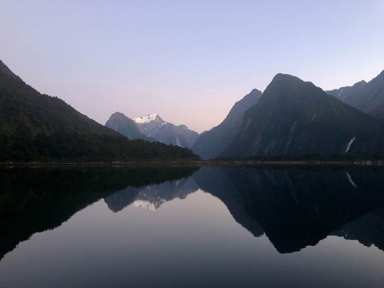
Milford Sound
We spoke to some that were skipping Milford because you can access it by road. We found Milford to be the most dramatic of the fiords. From Deepwater Basin we could see snow-capped peaks out our portlights and waterfalls everywhere after a good rain. When we departed from San Francisco on our five-year equatorial circumnavigation in 2015 I never thought that would happen! Wayne at the Fiordland Lobster company was able to get us on a mooring at no cost. According to the DOC Cruising guide, Reflections from Beneath, all other anchoring within Milford (outside of Deepwater Basin) has been shut down. We did a dinghy trip over to Harrison cove but never found the track listed in the guide. The girls had a good time playing in the beautiful river. We also took a day and hiked the ‘wrong way’ up the Milford track to some amazing waterfalls. Start early to avoid the lines of trampers coming the other direction. We tucked our dinghy behind the walking bridge at the Milford track terminus so it was not in the way of the hiker transfer boats. We regret not stopping at Anita bay to look for greenstone but the anchoring area was full of cray pots in storage and it was going to be tough to get anchored.
While in Milford we had to leave the boat to deal with some Immigration issues. It was easy to leave Banyan on a mooring, catch a bus to Te Anau and rent a car from there. This added a lot to our experience as we saw a part of the country overland between Milford and Bluff/Invercargill that we would not have seen.
George Sound
We did not get water in Milford although it was available at the dock in Deepwater Cove. We were therefore in need of water and used the hose at Anchorage Cove. These were the worst sand flies of our trip and if the weather is settled I would recommend just anchoring out. We draw 1.9m and were on the ground (low tide) when side-tied to the line in Anchorage Cove. You could tie further up the line but then the hose will not reach. Tying starboard side to (the hawser) might mitigate this problem depending on what your keel is like.
We then wandered down to Alice Falls. There is an existing stern line and we anchored in approximately 14’. While this anchorage is epic being right next to the falls (see the back cover of the Fiordlands cruising guide), you could anchor out to avoid the sandflies. The hike to the top of the falls is worth doing. You need to go up the dry creek bed 15 meters to the right of the actual falls. As this levels off, you will see a faint trail on the left that hits the lake and skirts the shore. There is an old canoe with some holes in the bow. If you’re only two and can stay in the back you can paddle it around without sinking (so we heard). If anyone is feeling determined, some glass and epoxy might make a quick fix of it and I’m sure others would appreciate it. The lake is much larger than you can see from this point and we’ve heard from others that it is awesome to paddle the length of it. We departed Alice Falls at sun up to make the passage to Thompson Sound and the Doubtful Sound Complex. FYI the sandflies get up early…and are VERY hungry in the morning.
Thompson Sound
We stopped in Deas Cove and side-tied to the line. This was the only side tie line that we used where one end was a mussel buoy on a mooring and the other end was connected to the shore. You unfortunately have to trust the fisherman on the integrity of many of these lines. There are some you can inspect and I always inspected what I could but there are times you cannot inspect everything. Many times the hawser is so covered in growth there’s no way to properly inspect it anyway. Upon departure from Deas Cove, a vessel ahead of us had wrapped the hawser on his prop and accidentally cut the hawser leaving only the back splice of the tail holding it all together. I notified the local fisherman and they sent someone to come inspect it. If I hadn’t inspected this after his departure, we never would have known it was no longer intact.
It was now February 21st and we had a forecast for 50 knots coming our way. We tucked up into Precipice cove in Bradshaw Arm. This anchorage is bomber (it’s the front cover of the cruising guide). The stern line is new and would probably hold a cruise ship. This is an example of a place we could have side-tied but we were expecting more vessels due to the forecast. We stern-tied to one side and were joined by 3 other vessels on the line, and a few others stern-tying to land. The last to join the lines was a local recreational fisherman. They were a little unhappy that the three stern-tied sailboats were taking up so much room…they wanted to side-tie. Before they came to blows with the boat next to them (who was accused of being from Auckland), I quickly jumped in the dinghy and helped us pull together a little more to get the local fisherman onto the line. They happily side-tied their big old Kauri fishing boat using, what looked like, very tired 1/4” poly pro lines.
We did a quick tour through Gaer Arm upon departure and would have loved to go up the river but the tides and forecast were not right to leave Banyan.
Doubtful Sound
We headed into Deep Cove as we’d heard you could re-provision. Billy and his wife at the Deep Cove Hostel were super sweet and helpful and allowed us to do a load of laundry. We ordered groceries one afternoon and they were delivered the next day, we also topped up diesel and petrol. Payment was made via credit card (preferred over cash). There are some great walks in this area and they are very well marked. The Deep Cove hostel has installed a fixed-line strung between two mussel buoys for visiting vessels. This limits the ability to anchor in this area but there was no charge to use their mooring line.
Noted in this area is the ‘tail race’ between the mooring line and the landing beach to the hostel. This is water leaving the Manapouri power station and flowing rapidly into the sound. At low tide, and with opposing wind, this can be a treacherous bit of water to cross in a dinghy. Plan your visit accordingly. We never found it to be impassable in our inflatable dinghy with solid bottom, but it was a bit exciting.
It was then off to the Blanket Bay Hotel to see a piece of history. The guide book mentions extensive services but for us it was all quiet. In 2021 the Kiwi Cray industry had an amazing year due to a spat between Australia and China. The prices for cray were up and most fisherman filled their quotas by the end of January and were done for the season. For this reason there were very few commercial boats still fishing. Upon arrival we did bump into the recreational fisherman from Precipice and they threw us six beautiful cray that were super yummy! We filled with water from the tap and went on our way. We heard from others that the moorings in the area can be used as long as you communicate with the fisherman. A quick call on the VHF Ch.10 will typically connect to a fisherman that is away and has a vacant mooring.
Dagg Sound
We anchored in the southern arm where there is a beautiful and extremely protected anchorage with loads of room to swing. We sat through four days of stormy weather and did see some significant 35+ knot gusts in this area. The waterfalls were amazing while it rained. There is also a nice hike departing from the head of the bay (left side) which leads to the head of Crooked Arm in Doubtful. Upon departure from Dagg, we had a forecast for 6m NW swell and 4m SW swell. We only had 24 hours between systems to move while the wind was down so we headed out. It turned out to be a washing machine experience with almost no wind on the outside. This was something we found regularly when traveling between sounds. The forecasted wind is often more than a couple miles (3-5) offshore and not often worth the trip out there to catch it. We typically motor-sailed at 3-5 knots at least a portion when transiting between the sounds.
Breaksea / Dusky Sound
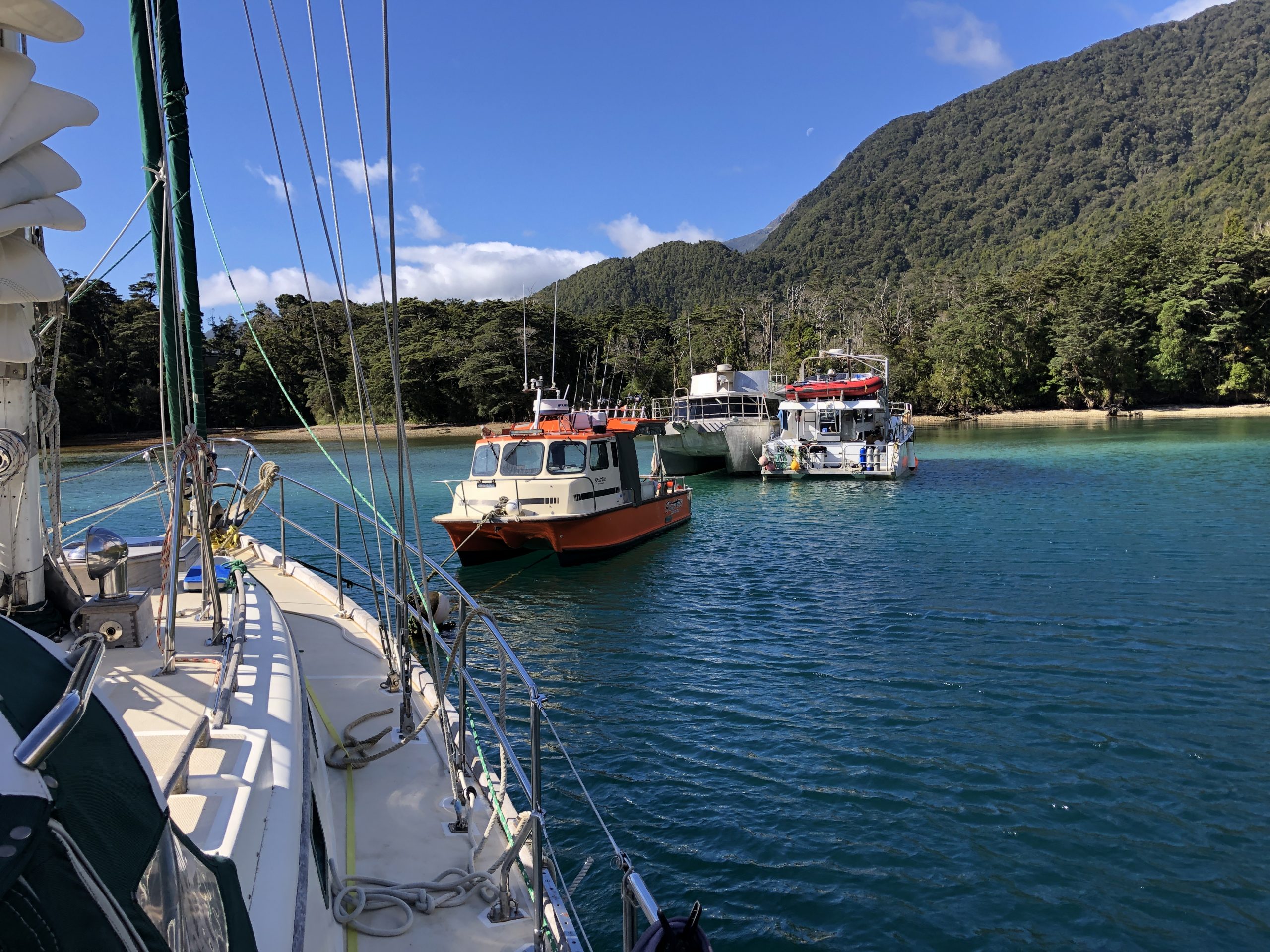
Due to another system hot on our tails, we scooted through Breaksea to get to Dusky. We were hoping to get to Fanny Bay but found the anchorage not tenable for the NW forecast as the wind was already funneling through and expected to build. We decided to head to Cascade Cove where we found the dive boat Tutuko 2 already tied up (bow to a bomber mooring and stern to a permanent stern line fixed to shore). They shot out to us in their dinghy and offered for us to moor alongside them. Once settled, they threw us two cray tails already cooked. As they departed the next day we took the mooring and the stern line from them. There is a water hose here but it was not working. I followed it up the creek bed and found the cistern clogged at the creek. It was cold work but I was able to quickly clean it and all of a sudden it was gushing water. We did explore this area by dinghy but could not find the trails listed in the guidebooks. The oyster boat “Kumea” is no longer in Cascade cove and has been replaced by a private floating bach with helicopter landings and a hot tub. During a rare thunderstorm, we were hit by a microburst that put our toe rail into the water…
The weather was very unsettled during this time but we made a quick visit to Pickersgill harbor to see the site where Capt. Cook did his refit. We did the very small hike to the point but there are more hikes in this area. Due to the unsettled nature of the weather, we chose to move on to Luncheon Cove. In Luncheon Cove we side-tied to the line, this is another example of an area where you cannot inspect what you’re tied to. If this bothers you, there are typically areas where you can anchor and pull yourself back to shore on your own gear.
Some cruisers did complain that moorings and lines had been permanently installed in most of the “advertised” anchorages. This is true and I think it’s due to the commercial nature of the people that work in these areas. They need a place to tie up quickly at sunset and are often off at sunrise. This is the truth whether they are fishing or running dive/hunting/hiking charters. We typically used these lines and the locals encouraged it. The coves where these lines exist are typically very sheltered.
As noted, there are very few boats in these areas. If you shared an anchorage with anyone, you were bound to share a cuppa with them and get at least a part of their life story. We loved this and our kids will never forget some of the characters that we met.
Luncheon Cove has many hikes and is miraculously light on sand flies. We actually spent time sitting in the cockpit without head nets. Due to the weather and our schedule we did not do this area justice but if you are a hiker then Dusky sound, in general, is worth more exploration. It was now early March and we needed to be in Dunedin in just over a month’s time. We had a window to head for Preservation, so we took it.
Preservation Sound
With another blow forecasted, we headed for Isthmus Sound. This anchorage is again bomber with stern lines tied to shore in three places. We tied to eye loops that came off this line. There is good cod fishing in this cove. The Tarawera Smelter is worth a visit and is a quick dinghy trip from here, you will see a large orange triangle hanging in the tree to mark the location.
The Preservation Lodge is also worth a visit. There are no services; the guidebook is out of date. It is a private lodge but the caretakers that were there when we visited were super friendly and knowledgeable about the area. We spent two nights in Weka Cove on Long Island. We side-tied on the port side of the old ferry that’s been converted to a fisherman’s shack. Preservation is another location that has maintained trails. They are found between the Preservation Lodge and Puysegur lighthouse. We hiked the Puysegur lighthouse trail and really enjoyed it. The dinghy landing bay is protected by a rock breakwater, be very careful at high tide as it’s barely visible. Two short rusty metal posts mark the entrance.
Fiordland to Stewart Island
Our Preservation Inlet time was cut short due to an amazing weather window to get to Port Pegasus on the south eastern side of Stewart Island. If you have the time, nothing’s broken and you’re not short on supplies, I would highly recommend heading directly to Port Pegasus from Fiordland. It’s much easier to travel from Port Pegasus to Oban vs. Oban to Port Pegasus. By taking this route, you also spend less time exposed to the nastiness of Foveaux Strait. Our weather window was brief and did not allow a stop at the Solander Islands but we have heard it’s worth a visit. You cannot go ashore, but as a bird sanctuary, to observe by boat, it’s reportedly beautiful.
There are little to no currents to worry about in Fiordland but Stewart Island is another piece of putty. You want to try to keep the current at your back and avoid wind against current as the seas can get gnarly. The cruising guide does a good job of laying out the currents in more detail than Navionics. Easy Harbour (west coast) is reported to be a good stop in order to wait for wind and current to organize themselves at your back when you round Southwest Cape. It’s amazing to think that the only other great southern cape that is further south, is Cape Horn!
Port Pegasus
We chose to do Port Pegasus in a clockwise direction in part based on our forecast. We started in Disappointment cove as once again we were expecting 40+ knots. The entrance is clear and there is a stern line at the end of the dogleg. The hike over to Broad Bay is short and easy, well marked, and well worth doing. After sitting out this gale we moved to the Billy’s Cove area to hike Bald Cone. We choose to anchor in the bay to the south of Billy’s Cove. This was very sheltered in our light SW. It was the first (and only) time that we had to fix our own stern lines to shore.
The trail to Bald Cone is very clear but the cairns can be easy to miss. The end of the hike involves fixed ropes; it was safe for a 12 and 13 year old. If you want any mussels, you will find a boulder completely covered with mussels at low tide as you enter or depart the creek on your way to the trailhead.
We then continued up to the Seal Creek and Reefer Cove area with an attempt to hike Magog. We never found the trailhead and realized later that you can really only find this trailhead at high tide or close to it which gives you very little time to hike to the top (with kids) and return while you can still get the dinghy out. The better bet is to hike this from Evening Cove. It’s a longer hike but we’ve heard the trail is somewhat clear and you don’t need to worry about the tides. After a couple of days in this area, we moved on to the Albion Cove area and stayed in Waterlily Bay. There is now a fixed stern line in this bay and a water line. The waterline was not running and I did not investigate further. We visited Smuggler’s Cove by dinghy which is well worth the visit. Finding water on Stewart Island was a little more difficult. We did fill up at the old settlement in N. Arm. The water was definitely a little more than slightly tea-stained from the tannin but we deemed it drinkable. Stewart Island is much drier than Fiordland. We felt it in our skin immediately upon arrival and also inside the boat as things were just drier.
Lords River
The Lords River area is very sheltered. We choose to free swing just inside the entrance to Deep Bay in approximately 10’ of water. There is a stern line further in “The Nook” which would be much more sheltered. There is a water hose but it was not working while we were there and we did not investigate.
Port Adventure
We spent multiple nights in Abraham’s Bosom (Redsand Cove in Navionics), free-swinging in 10-20’ of water. Large cockles are available in Oyster Cove. We did see a stern line on the east side in the Oyster Cove area. This would probably be a better spot in strong SW. There were regular deer and sea lions on the beach in Abrahams Bosom and many hunters in the area while we were there.
Preservation Inlet
Preservation Inlet is the more touristed portion of Stewart Island although there were still very few people. Anchoring in Golden Bay gives access to the roads and walking trails that lead into Oban. In general, the bay is very protected although in strong SW you need to move behind Lona Island and then the wind against tide can be uncomfortable. We chose to land our dinghy on the beach, to the right of the boat sheds. There is a trail that will get you to the road if you take a left, if you go right, it’s a more circuitous walk into Oban. Sydney Cove is worth a visit to walk the trails of Ulva Island. Millars Beach and the old Whaling station are also well worth a visit and protected. If you needed to leave a boat in this area, there are many moorings in the Faith, Hope and Charity group (just west of Golden Bay). A call to Maureen at Stewart Island Radio could probably secure one in short order.
We found Preservation Inlet to be a wind tunnel in general. There are well-protected anchorages with awesome holding but it’s hard to really get out of the wind when it blows. Look for high mountains and avoid any valleys or low cuts that are upwind of you. We sat through 50+ knots (SW to NW) in Little Glory and while very safe with good holding, I think the low hills only accelerated the winds. We also learned (too late) from locals/regulars that they partially fill their dinghies with water in these winds to stop them from flipping… which would have been very useful knowledge…
Oban is a great little town with loads of history. We chose to access it from Golden Bay. Half-Moon Bay, in front of Oban, is busier and more exposed to the swells. If you do choose to visit that area, you can contact Maureen at Stewart Island Radio and she can probably find you a mooring. There were many available when we were there and others were doing this.
Leaving Stewart Island
From Golden Bay/Patterson Inlet we chose to head for Dunedin/Port Chalmers. We were too heavy to hang on the docks at Otago Boating Club but heard great reports from other cruisers of their visit to this area. We found a mooring in the Port Chalmers/Carey’s Bay area. There are two visitor moorings that are free for two days. After that, there are some local moorings that are also available, just ask around. Steve, the harbormaster is super helpful. Water is available from the floating wharf in Deborah Bay, it had about 10’ of water at high tide. There are regular busses from Carey’s Bay to Dunedin for $3. Port Chalmers also has laundry and a Four Square. The Carey’s Bay boat works is surprisingly well-stocked and could probably get you anything you need for boat maintenance. In general, we loved this area.
Oamaru is another option to break up the trip north or south. It was recently dredged, has leading marks and the people could not be kinder. Fuel, groceries, and laundry are within walking distance as well as two breweries, lovely shops, loads of restaurants, cafes, and a rich culture. The old limestone buildings make you think you could be in France. Contact Otago Port Control or the Oamaru Boating Club (Kevin Murdoch, Commodore) for local knowledge prior to entering. There is anchoring but they can often get you a mooring that’s a little more sheltered.
We were loaned two pilot guides for ports along the east coast of the South Island which we found really helpful: Cruising Guide South Island East Coast Featuring Banks Peninsula by Evan Paterson and published by the Naval Point Club in Lyttelton, and Mana Cruising Club’s publication of New Zealand Cruising Guide, Central Area. There are worth ferreting out if you plan to head up or down this coast.
Annie wrote blog posts consistently and in more detail during our time through the fiords. If you want to read more, just search our blog (vawtersonthewater.com) under the category ‘Fiordland & Stewart Island’ or click here to find our posts and more photos from that time. Or, just reach out and we can have a chat about it.
In conclusion, these last couple of months have been a highlight of our time cruising. This region is very remote by modern standards and while this brings challenges, it also provides outstanding beauty and solitude. We’ve also found the people to be extremely welcoming, often inviting us into their homes after just meeting us on the beach. Foreign yachts are a bit unusual; you are not just another boat that’s passing through. If you and your vessel are up to the challenge then we highly recommend this area.
Cameron,
Thank you for such a thorough description of your recent NZ travels. There’s a book somewhere in all of this…you are whetting my appetite to visit NZ.
Sending much love and Blessings,
Marianne
Thank you Marianne! It’s well worth the trip, once it opens back up.
Wow Cameron, so many great details about each area, definitely could be a cruisers manual for 2021. Your family so adventurous & creative in meeting the needs of each destination. The photos are inviting as well & your blog is encouraging to those anticipating cruising Beautiful South Island of NZ. New Zealanders are very warm, friendly and inviting to their country.
Great blog, Cameron. Amazing presentation.
Doubtless your time is gold to sailors contemplating your same voyage.
Poppi